Old Maps and Globes > Holy Land Maps
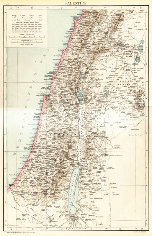
Palestine or The Holy Land Map During The Ottoman Period 1893. Published In Cassell's Universal Atlas.
Item#: MAH38
SOLD
Palestine Map from the 1893 Universal Atlas. This is a very detailed map of Palestine extending from Beirut in the north to the Dead Sea in the south. The map depicts the cities, towns and villages in the last quarter of the 19th century under Ottoman rule. The place names are Arabic or Hebrew written in Latin characters with the ancient biblical name in parentheses. Also shown are mountains, rivers and major roads. Cassell's Universal Atlas, was published in London in 1891-1893 using maps printed in Leipzig in English; These maps were originally drafted for Andree's Atlas (The first edition of which appeared in 1881) in German. The English version maps were also used in the Times Atlas of 1895-1900. Size 27 X 41 cm (10.5 X 16 inches)
Related Items
-
 Price: $65.00
 -
 Price: Contact us
 -
 Price: $120.00
Development: Epoch | Design: Luch
Copyright © 1999-2024 Gilai Collectibles. All Rights Reserved


