Old Maps and Globes > Holy Land Maps
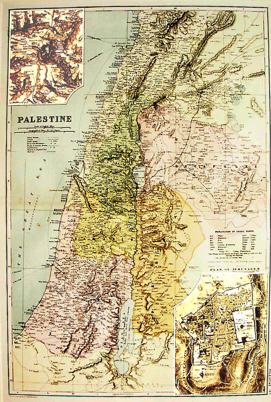
Map of Palestine 1896. Drawn, Engraved and Published by Bacon.
Item#: MAH1075
SOLD
Map of Palestine or the Holy Land. Drawn, Engraved and Published by: Bacon’s Geographical Establishment. Year Printed: 1896. Size (width X Height): 12 X 18 ½ inch. Color and Method: Color printed engravings. Map Description: The map shows the ancient Roman divisions: JUDÆA, SAMARIA, GALILEE, PHOENICIA, PERÆA and DECAPOLIS. Railways routes from Jaffa to Jerusalem and from Haifa to Damascus are printed as well as Steam routes to main Mediterranean ports. Inset Description: Plan of Jerusalem and the environs of Jerusalem, showing the relation between Bethlehem and Bethany to Jerusalem and the main sites inside the ancient city. Wilson ‘Ordnance Survey of Jerusalem’, 1865, bases the insets on the map. Index and Explanations: Scales in English and Geographical Miles about 15 miles to an inch. Main symbols used and explanation of Arabic words.
Related Items
-
 Price: $55.00
 -
 Price: $44.00
 -
 Price: $55.00
Development: Epoch | Design: Luch
Copyright © 1999-2024 Gilai Collectibles. All Rights Reserved


