
Old Maps and Globes > Jerusalem Maps
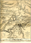
Geological Map of Jerusalem 1907. Engraved by Bartholomew. Published by Hodder & Stoughton, London
Item#: MAJ1100
SOLD


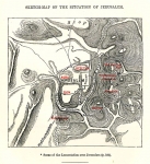
Geological Map of Jerusalem. Engraved by the Scottish cartographer John George Bartholomew, the Edinburgh Geographical Institute. Published by Hodder & Stoughton, London. Year Printed: 1907. Size (width X Height): 15 X 17 inch. Printed in discrete 4 colors. Map Description: The maps summarize the findings of Dr. Blankenhorn and published by George Adam Smith in his book: Jerusalem, the Topography, Economics and History. Vol. I, 1907. The template of the map is reduced by permission from the Palestine Exploration Fund’s plan of Jerusalem by Sir Charles W. Wilson, and the findings of 7 geological layers are printed in colors on top of the city plan.
Related Items
-
 Price: $60.00
 -
 Price: $76.00
 -
 Price: $65.00
Development: Epoch | Design: Luch
Copyright © 1999-2024 Gilai Collectibles. All Rights Reserved