Old Maps and Globes > Holy Land Maps
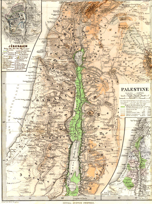
Map of Palestine, 1880. Drawn by Berghaus and Published by Justus Perthes for the Gotha Almanac.
Item#: MAH1087
SOLD
Gotha Map of Palestine, by Berghaus 1880. This unique map was drawn by Hermann Berghaus (1828-1890) and published by Justus Perthes for the Gotha Almanac. Size: 23.5 X 32.5 cm (9.2 X 12.8 inches). The map is steel engraved and colored in watercolors. Published in London in 1880. This map was taken from the Gotha Almanac of Ruling Dynasties and High Officials. This almanac has been in publication since 1763. In 1785, Johann-Georg-Justus-Perthes took over publication. Hermann Berghaus was this publication’s top cartographer. The map has two insets, Jerusalem, and the division of the land for the twelve tribes. The map is in good condition with slight creases from folding.
Related Items
-
 Price: $150.00
 -
 Price: $65.00
 -
 Price: $55.00
Development: Epoch | Design: Luch
Copyright © 1999-2024 Gilai Collectibles. All Rights Reserved


